Proposed Plan Change 5 – Peacocke Structure Plan
Feedback updated 26 Apr 2023
We asked
The proposed Peacocke Structure Plan sets out how the Peacocke area will be developed in the future and was updated to reflect the outcomes we want for our newest neighbourhood.
We asked Hamiltonians, landowners and residents in and around the Peacocke, our development community and key stakeholders like Department of Conservation, what they thought about the plans and rules we proposed for the future Peacocke community.
You said
We received a total of 58 submissions for Plan Change 5 and were subject to the further submission process and period from 16 February to 16 March 2022. Further Submissions to Proposed Plan Change 5 – Peacocke Structure Plan
We did
Hearings were held in late September 2022. Following this, the Hearings Panel issued decisions on Plan Change 5 and these were notified on 1 March 2023. The decisions were subject to an appeal period of 30 working days.
View the full proposed Plan Change 5 including submissions, evidence and recordings.
Published responses
View submitted responses where consent has been given to publish the response.
Overview
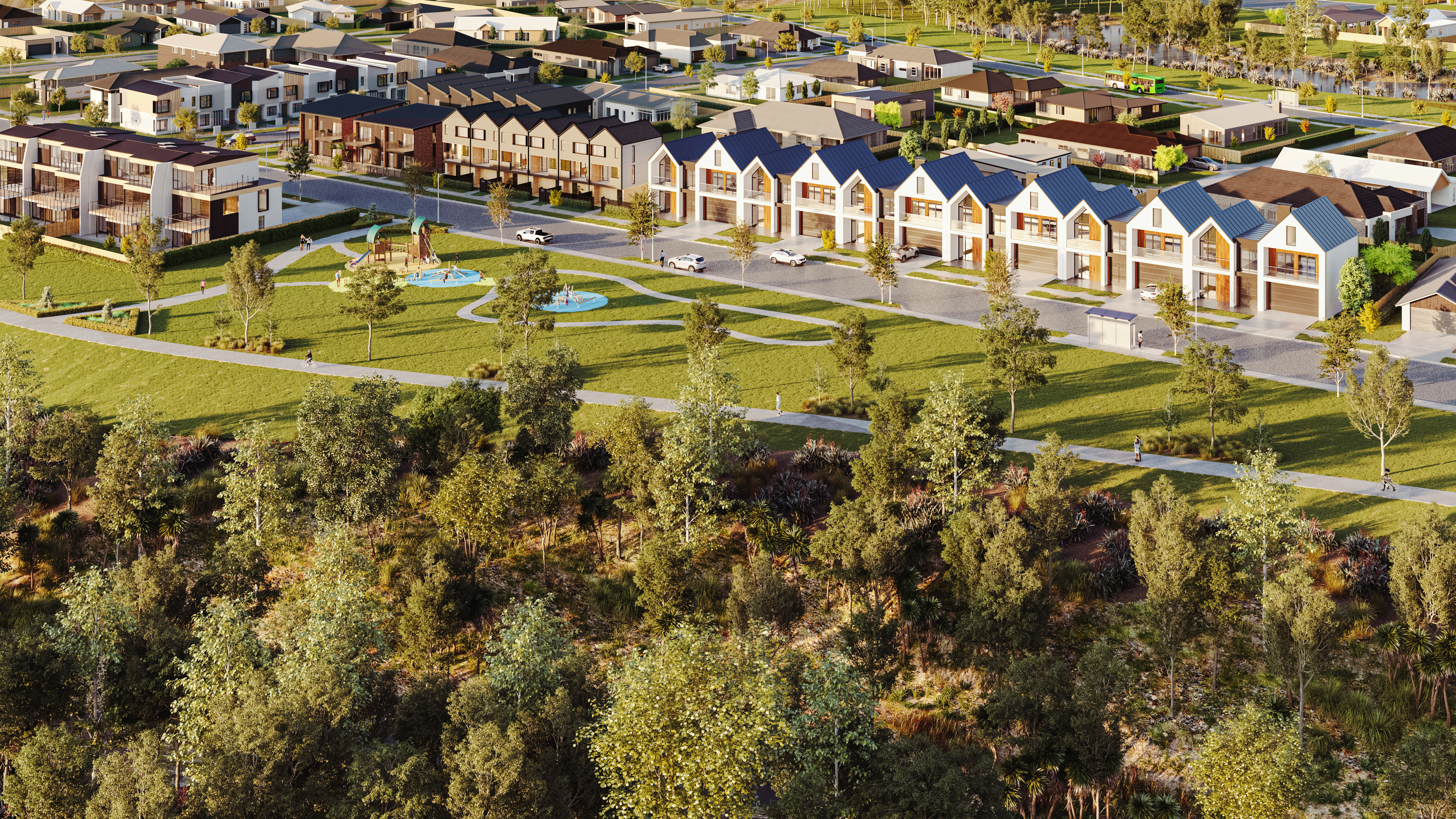 Conceptual image of new Peacocke community
Hamilton City Council has approved the proposed Peacocke Structure Plan (Plan Change 5) to be publicly notified and now is your chance to make a formal submission.
The Peacocke Structure Plan Area is located in the southern part of the city between the Waikato River, Ohaupo Road (SH3), Raynes Road and Peacockes Road. The purpose of the plan change is to enable urban residential development to create an attractive and sustainable community that will eventually be home to up to 20,000 Hamiltonians.
As this plan change is publicly notified, anyone can make a submission. A summary of the public notice has been placed in the Waikato Times on 24 September 2021.
The easiest way to view the proposed provisions is online at hamilton.govt.nz/PlanChange5.
A copy of the proposed Peacocke Structure Plan is available to view at all Hamilton City Libraries, and in the Ground Floor reception of the Council’s Municipal Building in Civic Square.
We've a lot more to share with you. Please scroll down the the bottom of the page to Related section.
Why your views matter
The Peacocke Structure Plan was created in 2007 and reviewed in 2012, in full public consultation processes. But a lot has changed since then. With funding for key infrastructure confirmed, and construction under way, the Peacocke Structure Plan now needs to be updated to reflect the outcomes we want for our newest neighbourhood. This includes environmental and urban design best practice and will bring our plan in line with the National Policy Statement for Urban Development and the National Policy Statement for Freshwater Quality, Government’s directions for how they want councils to develop well-functioning communities and healthy rivers.
The new infrastructure connections, like roads and pipes and subdivisions being built mean that Peacocke is already changing. We need to make sure it is changing in a way that reflects the outcomes we all want.
What's a structure plan?
A structure plan helps guide the development of a new area. It considers things like transport connections (including public transport, cycling, and walking), parks and open spaces, commercial areas, housing style and density, environment and cultural heritage and sets out the best place for each of those activities to happen. It will help us balance the need for housing with social, cultural, environmental, and economic outcomes for our community.
Proposed changes
The proposed Plan sets out how the Peacocke area will be developed; guiding housing style and density, transport connections and community spaces, as well as determining how the area’s cultural heritage and natural environment will be protected.
The key elements of the plan change include:
- The rezoning of approximately 690 hectares from General Residential Zone and Peacocke Special Character Zone to Peacocke Medium Density Residential Zone. This will enable up to 8400 residential units comprising a mixture of single dwellings, duplex dwellings, terraced houses and apartments.
- The rezoning of approximately 7.8 hectares from Peacocke Special Character Zone to Local Centre Zone to establish the main commercial centre within Peacocke.
- The rezoning of approximately 3 hectares from Peacocke Special Character Zone to Neighbourhood Centre Zone to allow the establishment of eight neighbourhood centres.
- Increase the Natural Open Space Zone from 16 hectares to 143 hectares. These areas of will include significant bat habitat buffers and corridors outside of the gully network, to join the Mangakootukutuku Gully network with areas outside of the Peacocke Structure Plan Area.
- The rezoning of 14 hectares of Peacocke Special Character Zone to Peacocke Sports and Active Recreation Zone for the purpose of establishing a sports park.
- The area of Significant Natural Area (SNA) will be increase to 58.2 hectares.
- A number of new archaeological sites have been identified and included on the Features Maps.
- The Waikato River and Gully Hazard Area overlay has been amended and a new Seismic Setback area has been introduced to reflect the work undertaken to identify hazards.
- New provisions are proposed to protect areas of significant bat habitat from future urban development. These provisions include controls over fixed lighting associated with urban development as well as a building setback from the boundary of Significant Bat Habitat Areas.
- It will include more details around the location of higher density areas and identification of the indicative transport corridor including proposed public transport routes.
- It identifies the indicative location of stormwater wetlands and areas of future open space.
- It also introduces a new infrastructure and staging plan for the Peacocke Structure Plan Area.
Key features of the proposed Plan are covered in our information booklet and the full proposed provisions can be viewed online at hamilton.govt.nz/PlanChange5.
Contact information
If you have any questions, please contact Mark Roberts on 07 838 6618 or email Mark.Roberts@hcc.govt.nz. Staff are available to discuss any concerns with you and can be contacted on (07) 838 6699 then ask to speak with the City Planning Unit or email districtplan@hcc.govt.nz.
What happens next?
Council staff will summarise all submissions following the closing date. This summary will be publicly notified on Council's website, in a local newspaper and printed copies will also be available from Council. Copies of the actual submissions will also be available to the public so that anyone can find out what specific issues have been raised. Council will then call for further submissions. This is the opportunity to support or oppose another person's submission, even if you didn’t make an initial submission. Further submissions can only be made if:
- you represent a relevant aspect of public interest
- you have an interest greater than the general public has.
Share
Share on Twitter Share on Facebook